
Infrastructure & Construction
Drone Division works with top construction and infrastructure companies for measuring large areas, land movement to stock surveys.
Our 2 services offer a faster, safer, precise and cheaper solution compared to traditional methods:
Photogrammetry: centimetre-accurate measurements on large areas.
Photogrammetry is used to obtain information from 2D data of mainly large areas. This information is converted into cm-accurate measurements, data points or 3D models. Drone Division is an expert in photogrammetry for volume measurement, 3D modelling, site tracking and detailed measurements on large areas.
Volume calculation: indoor and outdoor solutions
Drone Division offers a comprehensive solution for volume calculations, both indoors and outdoors.
Our advanced 3D Lidar scanning and photogrammetry technologies are trusted and used by numerous top construction and infrastructure companies.
Thanks to innovative technologies and powerful software, even huge construction sites can be measured quickly and safely with centimetre precision to meet your specific needs.

Photogrammetry
Increase security, reduce costs
Drone technology provides fast and secure data capture in all (inaccessible) large areas. Less time and risk for surveyors on site.
Innovative software provides detailed quality data:
✅ Cut/Fill volume
✅ 3D modelling
✅ Centimetre-accurate calculations
Better planning and monitoring of projects
Our dedicated tools facilitate efficient monitoring of project progress and inventory data, accessible to all teams 24/7.
With this level of precision, travel time and the need for frequent site visits are significantly reduced, freeing up valuable time for other important tasks.

Volume calculation
Efficient and secure large-scale data collection
Our solution uses drone and 3D technology to quickly and securely capture data in inaccessible areas, freeing surveyors from time-consuming and risky tasks.
Powerful software delivers detailed quality data for indoor & outdoor:
✅ Cut/Fill volume
✅ 3D modelling
✅ Centimetre-accurate calculations
Detailed reporting
Specific tools report centimetre-accurate data for indoor and outdoor volumes. Volumes to be added/removed are displayed on detailed reports for precise project follow-up.
Why choose Drone Division
INSPECT quickly and safely
Our volume measurement and photogrammetry solutions are used in various sectors such as surveying, infrastructure and construction planning, progress control, warehousing and earthmoving.
They reduce time and costs on site, increase safety and improve productivity.
🏋️ 0% downtime
👷🏽♂️ 100% worker safety
💥 up to 300% faster than regular inspections
🥂 200% less costs
MEASURE, analyse and manage
Powerful software is used for quick and easy calculation of cut/fill volumes and progress monitoring.
This information can be processed in various tools, adapted to your needs.
✅ Centimetre-accurate measurements
✅ Measuring with maximum safety and speed
✅ Available 24/7 for your team and stakeholders
REPORTing to your needs
Automated reporting for fast decision-making and control.
Deliver:
Orthographic images
3D point clouds
Quality report with detailed dimensions and volumes
Proven trusted and used by top construction & infrastructure companies for authorised asset management.


Competitive advantage
In the world of construction, 3D scanners and drone technology have become essential tools. The ability to provide accurate measurements, collect data efficiently and track project progress gives companies a significant competitive advantage.
By using these technologies, companies can work more efficiently, save costs and provide a higher quality of service to their customers. It is therefore essential that companies doing construction work invest in 3D scanners and drone technologies to grow their business and be successful in the industry.
3D scanning
A 3D scanner is a device that uses laser beams to measure and capture the shape and dimensions of objects in a 3D digital representation.
This is invaluable for construction companies involved in the design and construction phases of projects. 3D scanners can be used to provide accurate measurements of existing structures, which is crucial for creating detailed and accurate plans for renovation or new construction projects.
The use of 3D scanners can lead to significant time and cost savings through efficient data collection and accurate modelling.
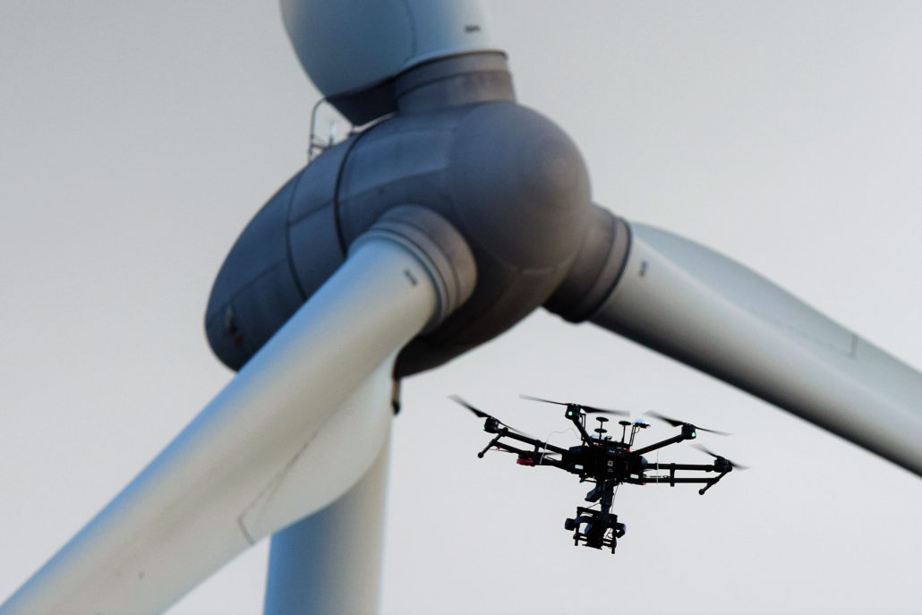
Drone technology
Drone technology is another valuable tool for construction companies. Drones can be used to take aerial photographs of construction sites, which is important for mapping the scope of the project, identifying potential problems and tracking progress. Drones can also be used for inspection and security purposes, improving worker and site safety. By using drones, companies can work more efficiently and provide a higher quality of service to their customers.
 Site under construction