Drones in land surveying
Drone Division unburdens surveyors.
Drone Division strengthens your expertise by deploying drones, relieving you of administrative and legal difficulties.
Thanks to our solutions and aviation expertise, you can concentrate on collecting valuable data and processing.
⚠️ But the legal framework can consume your time and profit.
Using drones may take up 1% of your remit, but can become up to 10% of your time commitment due to constantly changing legislation and specific aviation regulations. Your expertise lies in obtaining and processing accurate data.
We provide:
✅ simple checklists compliant with legal provisions
✅ operations manual with specific procedures for flights in high-risk areas
✅ Smooth flying throughout Belgium (port areas/SEVESO/ISPS zones)
✅ Drone Division support for all your questions
✅ a team of 7 pilots available to solve your capacity problem
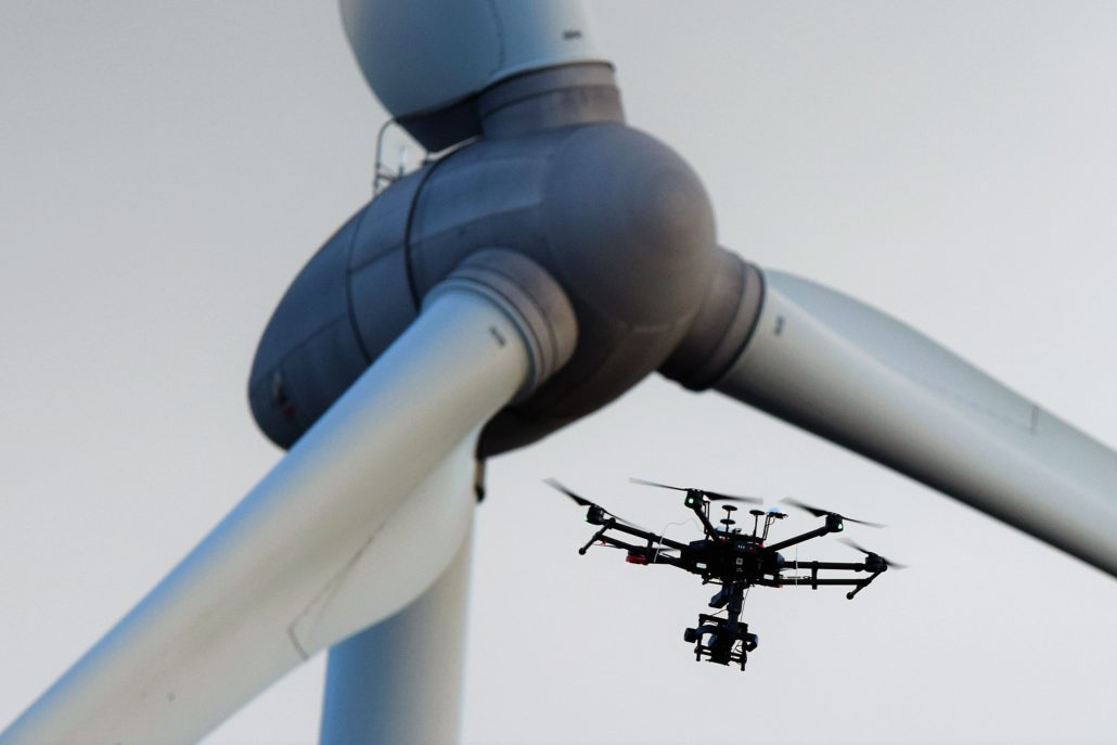
Why use drones for surveying?
🚀 New technologies perform certain tasks faster and more efficiently.
Technological advances within surveying are not only applicable to theodoliths, laser scanners or total stations.
The aerial viewpoint of drones offers specific advantages for surveying such as increasing speed, safety and accessibility during data acquisition.
- Fast data capture and easy project overview
- Reduce your time for execution of environmental study.
- Increase overall safety by reducing travel and avoiding hazardous environments on sites.
- Ideal for measuring inaccessible areas, stock piles and industrial sites.
- Progress of works can continue unhindered.
✅ Drones are a complementary measurement technique for you as a surveyor.
A drone guarantees gains for specific surveying techniques to complement your existing surveying techniques.
It reduces costs by reducing time and deployment of resources. And cheap yet quality technology reduces the purchase price of accurate drones and payloads.
 Feel free to ask how Drone Division can enhance your expertise.
Your contact: Stefaan Degryse
Mobile Stefaan: +32 497 45 47 27
Mail: info@dronedivision.be
Why choose Drone Division?
INSPECT projects safely and quickly
In-House developed methodology and drone flight procedures for maximum data analysis with custom annotations.
On-site time and cost savings; increase safety and productivity:
🏋️ 0% downtime
👷🏽♂️ 100% employee safety
💥 up to 300% faster than regular inspections
🥂 Reduce costs by 200%
Measure and analyse
Quickly analyse your annotations, anomalies and volumes.
In-house developed solutions reduce your time and resources by providing customised datasets for building strong reports.
✅ Detailed identification and location data
✅ Centimetre-accurate measurements possible
✅ Simple data enrichment
✅ Automated nomenclature of data and files
✅ Always & everywhere available for your team and stakeholders
REPORT according to your needs
Automated customised reporting for fast decision-making and documentation. Detailed data export to your systems possible.
Proven and used by top infrastructure & construction companies.

Where can I fly?

Safety first
Our partners in infrastructure and construction


Measure large areas quickly and safely

Easy stock monitoring
Ready to land on your project...
For more information, please contact us at info@dronedivision.be.
 Site under construction

